Category:Maps of the history of North America
Jump to navigation
Jump to search
Temperate regions: North America · South America · Africa · Europe · Asia · Oceania – Polar regions: – Other regions:
| NO WIKIDATA ID FOUND! Search for Maps of the history of North America on Wikidata | |
| Upload media |
Use the appropriate category for maps showing all or a large part of North America. See subcategories for smaller areas:
| If the map shows | Category to use |
|---|---|
| North America on a recently created map | Category:Maps of North America or its subcategories |
| North America on a map created more than 70 years ago | Category:Old maps of North America or its subcategories |
| the history of North America on a recently created map | Category:Maps of the history of North America or its subcategories |
| the history of North America on a map created more than 70 years ago | Category:Old maps of the history of North America or its subcategories |

Subcategories
This category has the following 29 subcategories, out of 29 total.
"
*
C
D
E
G
- Maps of the history of Greenland (20 F)
H
I
M
- Maps of the Cuban Missile Crisis (22 F)
N
- Maps of New Sweden (29 F)
P
S
T
U
W
Media in category "Maps of the history of North America"
The following 51 files are in this category, out of 51 total.
-
 Oasisamérica-Hohokam.png 766 × 965; 1.19 MB
-
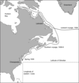 1508 voyage.png 1,971 × 2,077; 366 KB
-
 Coronado expedition.jpg 1,230 × 532; 130 KB
-
 Political Evolution of Central America and the Caribbean 1700 and on.gif 850 × 638; 348 KB
-

-
 Americas independence map.PNG 862 × 1,270; 74 KB
-
 Andean Community.png 418 × 628; 14 KB
-
 Arctic cultures 900-1500.png 259 × 989; 251 KB
-
 Beringia land bridge-noaagov.gif 700 × 458; 367 KB
-
 Bisons.JPG 1,262 × 1,107; 313 KB
-
 Book B10-178 Bethleham Iron.png 2,070 × 3,016; 70 KB
-
 Brockhaus and Efron Encyclopedic Dictionary b2 604-3.jpg 2,552 × 3,459; 3.45 MB
-
 Evolucion Territorio Mexicano.gif 626 × 599; 1.28 MB
-
 Evolución territorial de México (1821-1981).gif 800 × 760; 466 KB
-
 Expedition Cabeza de Vaca Karte borderless.png 1,990 × 895; 2.28 MB
-
 First Nation Control over North America about 1600 AD.jpg 5,660 × 5,196; 23.06 MB
-
 French Forts 1754.jpg 296 × 372; 108 KB
-
 French Forts 1754.png 263 × 386; 17 KB
-
 History of the American Civil War (1867) (14575956700).jpg 3,344 × 2,102; 965 KB
-
 History of the American Civil War (1867) (14760302234).jpg 2,010 × 2,882; 916 KB
-
 Ien.35556000974097-seq 87.tif 5,227 × 7,681; 17 MB
-
 Ivo 2007 track map.gif 895 × 716; 28 KB
-
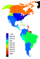
 Latin American independence countries.png 505 × 600; 73 KB
-
 Lewis and Clark track map published 1814 LoC.jpg 8,784 × 4,032; 8.71 MB
-
 Locatie Eerste Mexicaanse Keizerrijk.PNG 250 × 115; 5 KB
-
 LocationRioGrande.PNG 250 × 115; 1 KB
-
 Map of North America (1898).jpg 2,926 × 2,414; 1.22 MB
-
 Map of North America, 1782 (Life of William, Earl of Shelburne) (edited).jpg 1,733 × 2,692; 3.86 MB
-
 Map of North America, 1782 (Life of William, Earl of Shelburne).jpg 1,733 × 2,692; 3.11 MB
-
 Mapa Terytorium Indiańskiego w XIX wieku.png 427 × 585; 64 KB
-
 Mitchellmap-1755-telliquo.jpg 528 × 410; 75 KB
-
 Namigration.png 686 × 717; 219 KB
-
 NOAA Saint Paul Island elliott4.jpg 1,148 × 1,639; 494 KB
-
 North America 1810-1816.png 1,000 × 1,274; 422 KB
-
 North America in 18th century (pl).png 341 × 439; 27 KB
-
 North American lines of frontier, 1782 (edit).jpg 2,696 × 1,656; 2.78 MB
-
 North American lines of frontier, 1782.jpg 2,696 × 1,656; 2.26 MB
-
 Nouvellefrance-V2.jpg 1,530 × 1,090; 1.04 MB
-
 OAS membership map.png 418 × 628; 14 KB
-
 Oasisamerica.png 766 × 828; 949 KB
-
 OldestContinuouslyInhabitedCitiesInTheAmericas.svg 1,264 × 1,046; 876 KB
-
 Sobel North America.JPG 457 × 431; 52 KB
-
 The Beaver map (1715).jpg 424 × 700; 152 KB
-
 TramCCFLmapa(NAmerica).svg 1,400 × 1,150; 313 KB
-
 Viking expansion.png 507 × 310; 109 KB
-
 VillistasvstheUnitedStates1915-1920.jpg 885 × 1,566; 238 KB
-
 Vinland-travel-hy.jpg 1,214 × 1,600; 488 KB
-
 War 1812-Locations.jpg 1,494 × 830; 139 KB
-
 Western North America 1778.png 1,202 × 1,213; 230 KB
-
 WikiConference North America 2018 - Bjork-James - Bellin map.jpg 4,032 × 3,024; 8.53 MB
-
 WikiConference North America 2018 - Bjork-James - European occupation.jpg 4,032 × 3,024; 9.1 MB


.gif)


_(14575956700).jpg)
_(14760302234).jpg)


.jpg)
_(edited).jpg)
.jpg)


.png)
.jpg)


.jpg)
.svg)


